How to create a zone?
Zones enable you to include or exclude areas for reporting (also referred to as “geofencing”). Once you’ve configured some zones, you can use them in your report definitions.
You can configure a zone yourself, or import a .KML file to define your zone. See Google’s KML Documentation Introduction for more information about KML.
Zones (created or imported) can contain a maximum of 100 points.
To create a zone
- Click Configure > Zones
- Click the [Create] button:
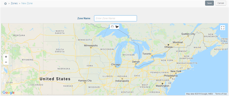
The Zone definition screen appears.


- Enter a Zone Name.
- Click and drag the map (
 ) and use the +/- buttons to navigate to the desired area on the map.
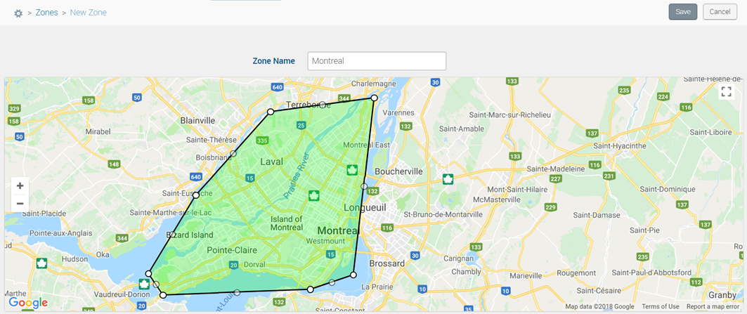
 - Use the Draw a shape tool (
 ) to define your zone.
- Use the full-screen mode (
 ) to increase the screen size for drawing the zone.
 - To move a point, click and drag it.
- To delete an existing point, click it.

- Use the full-screen mode (
- Click Save.
To import a zone
- Click Configure > Zones
- Click the [Import] button:
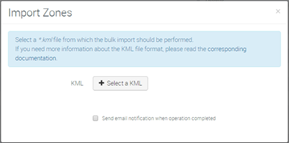
The Import Zones window appears.


- Click the Select a KML button and select the desired .KML file on your computer.
- Click Open.
- On the Import Zones window, click Start. The .KML file is uploaded and your new zone appears on the list.
Managing Zones
Move your mouse over the Actions column to view the available options for a zone.
| View | View the zone map | |
| Clone | Duplicate the template of the selected zone | |
| Delete | Delete the zone from the list |
 Searching...


